
 BACK
BACK  CLOSE
CLOSE 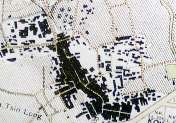
Sha Po Village as it appeared on an old map
A 1924 map showing Sha Po at the bottom right near the east of the Kowloon Walled City and Kowloon Main Street-A topographic map made by Public Works Department in 1924 (extracted), in Hal Empson, Mapping Hong Kong : a historical atlas (Hong Kong : Govt. Printer, 1992).
Sha Po Village’s four-hall houses of bamboo barrel-style
There were more than 30 clustered houses in Lower Sha Po (3 houses as a cluster). Hung Gu and her family lived in the first house of one of these clusters. Another one was occupied by a family named Lee. The village houses in Sha Po were quadrangles, the layout included bedrooms, living rooms, courtyard and gatehouse. They were larger than the houses in Nga Tsin Wai. As their shape looked like the bamboo tube, they were dubbed as ‘bamboo tube house’. The living room had a high ceiling, and the cockloft was large enough to accommodate 2 to 3 beds. Hung Gu and her brothers slept in the cockloft and their parents had the bedroom. The courtyard was the place for cooking or bathing, the big stove for cooking pig forage was also placed in the courtyard. The gatehouse was a roofless house with a small door. Hung Gu’s family kept 6 pigs on one side of the gatehouse, and the other side was used for storage.