
 Stories
-
01
The old airfield gates
-
02
Flying in & out
-
03
The old runways
-
04
Hangar for sale
-
05
How I went for work
-
06
The old Kowloon East
-
07
The old Kowloon Bay
-
08
The 1956 Riot
-
09
Making of 13/31
-
10
The new public estates
06

Albert
What was it like in the neighbourhood of San Po Kong and Kwun Tong? I mean, in the early 50s, before Kwun Tong was developed?

Lau Yee Kow
At that time Kwun Tong was not yet a town, and Ngau Tau Kok had no buildings…
Ngau Chi Wan in the 50s
Wooden huts were all over Diamond Hill, and there was a studio. It was home to many, like Kowloon Walled City. (In Ngau Chi Wan) there were farmlands growing vegetables and grains.
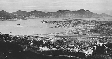
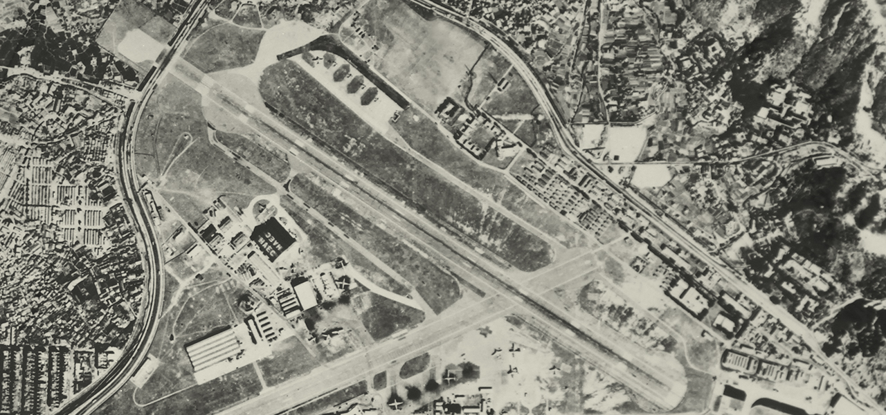
A view of Kai Tak Airport from Tate’s Cairn. The photo shows Diamond Hill squatter area at the foot of Tate’s Cairn, including Tai Hom Village, Sheung Yuen Leng Village and Ha Yuen Leng Village. We can also find the adjoining farm villages of Ngau Chi Wan, including Ping Shek Village and Pak Uk Tsai.
Huen Shing
At that time Tai Hom Village was a silk-stocking district…
Tai Hum Village in the 50s
Tai Hom Village was a gorgeous place. It was prestigious; only the rich to lived there. We didn’t even dare to go look at the houses, because only those with deep pockets could move in. They were houses of one or two storeys. Later it looked messy, but it was nothing of the sort at that time.
Lau Yee Kow
It was very desolate around Ping Shek…
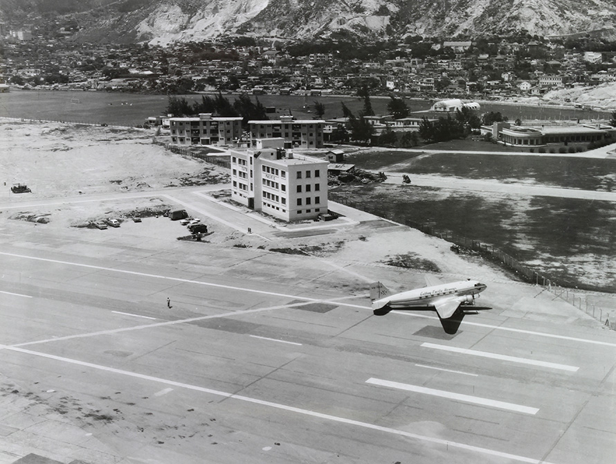
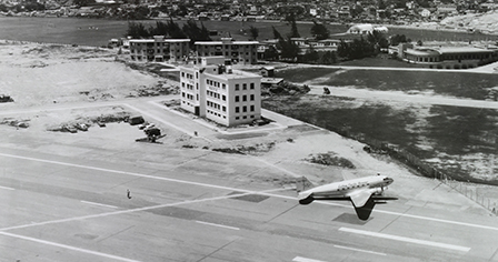
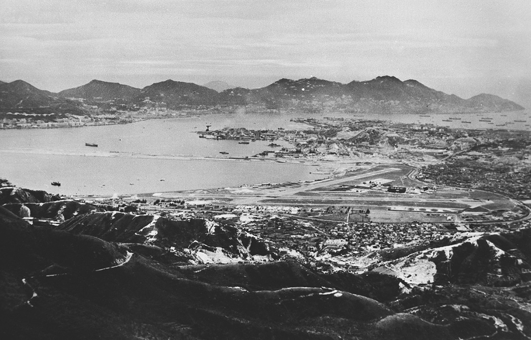
In the middle of the photo is the office building of Cathay Pacific, which neighboured the HAECO area. The site had been an airline catering building of Taikoo and Cathay Pacific until 1998 when Kai Tak retired. Part of the lawn on the right and at the back belongs to the RAF base.
San Po Kong and Ngau Tau Kok in the 50s
The whole of San Po Kong was the airport area. Where Rhythm Garden is today belonged to RAF, and Ho Lap College was the runway. There were roads; Bus No.9 and No.5 ran through it, and the terminus was at St. Joseph's Anglo-Chinese School. Ngau Tau Kok was not yet developed at that time. There was only one footpath to Ngau Tau Kok. It was undeveloped, and all it had was wooden huts, and the footpath verged on the hillside.

Yiu Yu Tim
Today the road near St. Joseph's Anglo-Chinese School is called Choi Shek Lane (lit. Colour Stone Lane). It was indeed a “Choi Shek Lane” (lit. Collect Stone Lane; “colour” and “collect” have the same sound, “Choi”, in Cantonese) in the past…
Ngau Chi Wan and Ngau Tau Kok in the 50s
At today’s Kai Tak Mansion was a mound, with the police headquarters on the top. The side facing St. Joseph’s was rocky, so many people quarried stones there. They made some crude tents out of gunnysack and bamboo and went quarrying. There was a one-way lane, and a bit further was a blasting site. The lane was narrowest approaching Amoy Gardens. You would lose balance If you were not very good at cycling. I myself went off balance one time. It was a gravel road so it really thrust you aside. Cycling there, the slope was on the left, and the development area on the right was wire fenced. At the end of Amoy was a ditch, so it was also the lane’s end. It was a factory area, like leather factory and glasswork factory… When I was small I went there to pick up goods for my family.
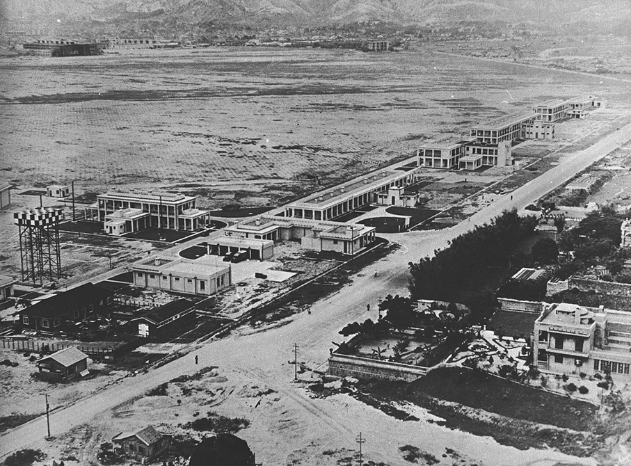
RAF Kai Tak and the surrounding community in the late 30s. In the middle is Kwun Tong Road near Kai Yip Estate today. The mansion in the bottom left corner was later donated to become St. Joseph’s Anglo-Chinese School. The byroad next to the mansion is today’s Choi Shek Lane; we can see that the surrounding area was already a grubby, dust-filled quarrying site.
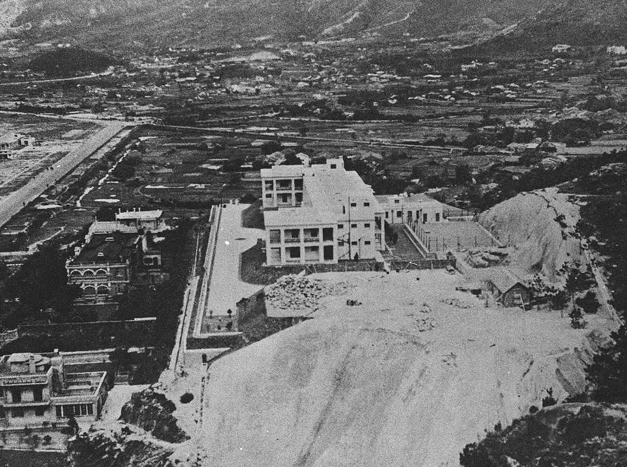
RAF dormitory building constructed in 1935. The structure was founded on the slope off Kwun Tong Road near Ping Shek Estate today, right behind Sam Shan Kwok Wong Temple. The site became the property of the Police Force after RAF withdrew in the 1970s. Survived through today, it is now listed as a Grade I historic building.
In the distant left is St. Joseph’s Anglo-Chinese School, then newly built. The hills close by were evidently defaced by prolonged quarrying.

Chan Kam Cheung
The Kwun Tong satellite town only appeared in the 60s. I was among the first group to move in…
Kwun Tong in the 50s
I moved to Kwun Tong in 1959. At that time Choi Hung Estate was still under construction, and I lived in Garden Mansion. When I moved in, Ngau Tau Kok was the farthest I could get to by car; there was not even a roadway, and I felt like I was “sold like pigs”. My co-workers in the airport told me I could apply to live in Kwun Tung. They said it was easy; our engineers took someone in the Housing Society out for dinner, and we needed only to queue up for registration in the office. Then we got in, so it’s really easy.
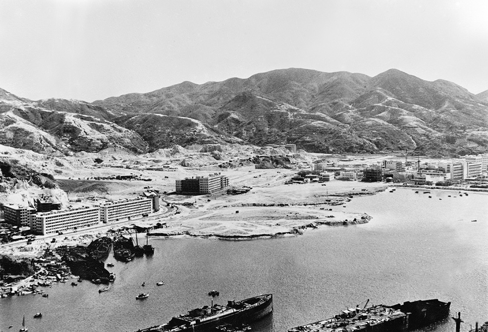
Ngau Tau Kok and Kwun Tong under reclamation in the 60s. Ngau Tau Kok Road and Kwun Tong Road were put up along the former coastline in this district. Left of the photo is Garden Mansion, then newly developed.
Copyright ©2013. Hong Kong Memory Project 香港記憶計劃 版權所有